Signals Tell about Hurricanes
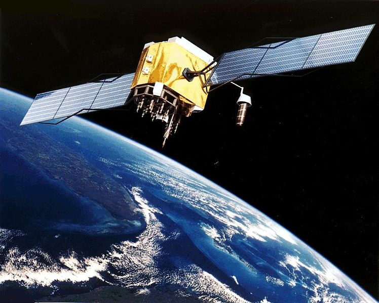
Got a GPS somewhere in one of your electronic devices? If you’ve ever hiked, driven a car, used your smartphone, flown in a plane, taken a train, or seen a barge heading down a river, it’s likely the journey included the use of GPS as a direction and location finder. GPS stands for Global Positioning Satellite system and it works by sending signals between satellites in orbit and receiving stations on Earth. Encoded in the signal stream back and forth between the two is the location of both the satellite and receiver, their rates of travel (velocities), and the precise time at each member of the pair. As you move, the unit records your location and time you were there. In this way, a GPS-enabled receiver can help you determine when you’ll arrive at a destination, assist a pilot in knowing where his or her plane is in relation to the ground, train engineers to know their locations, and so on.
A few years ago I wrote and co-produced (with Mark C. Petersen) on a series of short vodcasts (video podcasts) for MIT’s Haystack Observatory about space weather, and how atmospheric scientists use the effects on GPS signals to measure how solar outbursts affect our planet’s magnetosphere and technology. It’s called Space Weather FX, and well worth watching to learn more about this specialized use of GPS.
It turns out that GPS signals can also be affected as they encounter heavy seas during strong storms. In a paper published in the journal Radio Science, a team of researchers have found a way to use GPS signals to measure and map the wind speeds of hurricanes. How does it work?

Think of the radio waves bouncing from GPS to the surface of Earth or the ocean the same way you would think of light bouncing off a mirror. When a radio wave from a GPS satellite strikes the ocean, about 60 percent of the signal reflects back toward the sky. Unlike a mirror, however, the surface of the ocean is rarely calm and flat. Wind blowing over it generates heaving waves. According to Stephen Katzberg, a scientist at NASA’s Langley Research Center in Hampton, VA and one of the people developing a technique to use GPS to measure atmospheric disturbances during hurricanes, GPS could allow improved wind speed measurements. These could help meteorologists predict the severity of a storm more accurately.
“Imagine you blow on a hot bowl of soup,” Katzberg explained. “The harder you blow, the bigger the “waves” are in the bowl.”
When a GPS signal strikes a wave on the ocean, the rough surface distorts the reflection by scattering the signals in various directions. “The radio wave bounces off the waves,” said Katzberg. “As the surface gets rougher, the reflections get more disturbed and that’s what we measure.”
The technique uses measurements taken by GPS receiver chips, similar to those found in smartphones, located inside the Hurricane Hunter aircraft flown during heavy weather events to gauge the characteristics of hurricanes and tropical storms. A computer compares signals coming directly from satellites above with the reflections from the sea below and calculates an approximate wind speed. The accuracy of the calculation is better than 5 meters per second (about 11 miles per hour) in accuracy. The wind speed of a mid-range, Category 3 hurricane, for comparison, is about 55 meters per second (123 miles per hour).
For years, atmospheric researchers have been using dropsondes to measure wind speeds, temperatures, humidity, atmospheric pressure and other data about storms. These are instrument packages jammed with scientific instruments, which are attached to little parachutes and dropped into storms. They cost about $750.00 each and each Hurricane Hunter mission uses about 20. They remain the gold standard of storm measurement systems because they can be dropped in and around storms. They’re also more accurate than the GPS method. But, the advantage of the GPS system is that it can run non-stop and provide data over a much larger area around a storm. The goal is to use the GPS technique in conjunction with dropsondes to provide a constant view of the changing conditions of a strong storm. With more data, scientists can get ever-finer views of large storms, which will contribute to better storm predictions.
This new GPS measurement technique is being tested on planes, but it may also get implemented on a series of small satellites called the Cyclone Global Navigation System, currently in study and due to be launched by NASA possibly in 2016. They will measure reflected GPS satellite signals from low orbit to monitor storm wind speeds from space. It’s also possible, according to Katzberg, that signals from the DirecTV and Sirius XM Radio satellites could be used in addition to GPS to provide even more storm monitoring. “Those signals are extremely powerful and easy to detect,” said Katzberg. “These satellites cost hundreds of millions or even billions of dollars, but our system only costs a few hundred. We’re taking advantage of the expensive infrastructure that’s already there.”
What I find interesting is that that these kinds of “Earth-facing” studies are exactly the kind of planetary exploration that we’ve also done at other planets using radio science antennas and radio signals to probe atmospheres. It’s just being done with GPS here on Earth, which brings the idea of planetary exploration close to anyone who’s ever used GPS to explore their neighborhood, a new town, or even a new continent.
(Hat tip to the American Geophysical Union for sending me a heads-up about this so I could delve in and write a story about it. Truly fascinating!)
